Author’s Blog 22 June ’26:
The North-West Stock Route – pt3: ‘The Northern reaches’
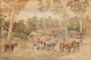
Part three and the final in The WA’s Early Days series’ focus on the North-West Stock Route from Toodyay to Geraldton.
The track beyond ‘The Diamond of the Desert’ oasis site was fascinating, with a series of pristine freshwater lakes and caves, all fed by the same mighty underground river that stretches down WA’s Coral Coast:
“Less than an hour further on they found a series of large limestone caves alongside a creek bed with high limestone cliffs. Tall river gums, giant zamia and manna gum lined the edges of the gully floor, while on the upper slopes could be seen brightly coloured wattles, parrot bush and native wisteria. At the end of the creek they found a large limestone cave, some 300 metres long, which the party used as a natural confinement for stock as they camped overnight. It had a sandy bottom and the atmosphere of a large amphitheatre. It was cool and comfortable, and the singing and yahooing of the settlers echoed through the gully. Burges had named it ‘Stockyard Gully’.
After this they hit claypan country, never far from claypan lakes and the grassy flats which are found near them. There were several large lakes in a long system, some of them with large semi-permanent pools of freshwater. They stopped at Lake Indoon, a beautiful clear lake where they rested, the lake surrounded by a sandy beach and with large flooded-gums on the banks drooping over the water. The party bathed here and some men swan out a distance, yelling back to the group that they could barely reach the bottom.
They continued northward through the Weelawadgie flats and more clay-pan country surrounded by casuarinas, gums and low-lying heath for roughly 10 kilometres until they reached the allotment purchased months earlier by the Hamersley family, the large and chaotic family that had so helped Maggie and the baby. Here, several single men were also to stay on as labourers to help the family fence and manage the massive allotment of 20,000 acres. It was named ‘Woodada’ and would be the basis for the Hamersley family’s expansion throughout the north and beyond. It seemed an unlikely place for a base, noting the allotment lacked a visible source of water although plenty was to their immediate south. But in the coming years labourers and convicts would dig a massive well measuring six metres in circumference and 25 metres deep, and which is still producing water to this day.
A further day’s march north, they came to Lake Arrowsmith, another beautiful lake with clear water and a sandy bottom set among large swamp gums and paperbark trees, where they rested and replenished.
The next day they set off early, striking out for a watering area that Burges said was a full day’s march north, getting there just as the sun set after a hectic day’s ride. This area comprised of swamp areas, dried clay-pan lake beds and thick wattle bushland, and Burges set more of the convicts and their guards to the task of digging a well to the north of the swamp, the site identified through the presence of water reliant plants.
They rested here for the night but again left early, the small handful of guards and convicts remaining behind. For Burges was now setting out stridently for his own destination, Irwin River Flats which was to become the headquarters of The Cattle Company in the region and Burges’ own new homestead, Yardarino. Most of the remaining settlers and labourers would be billeted to their lands from here, spreading across 56 kilometres of winding bends and twists.
At midday they crossed the Irwin River itself at Milo Crossing before finally arriving at the Flats. As they approached they heard the unmistakeable sounds of livestock across the river plains, and they travelled on through overgrown grass, native reed yangets, casuarinas and flooded gums that lined the banks of the river.
The settlers felt they had arrived in paradise, and mutual congratulations were passed around with handshakes – they were finally at their Journey’s end.”